
When sharing a grid reference, bushwalkers must be clear on the reference system being used, else the points will not necessarily match up. Maps that show the same terrain can be made using different datums and projections, meaning that the grids do not necessarily line up.
For example, compare the images of the Megalong Valley below, and notice that the location of all features relative to the grid lines is different. This is because the first map below uses an older datum than the one below that.
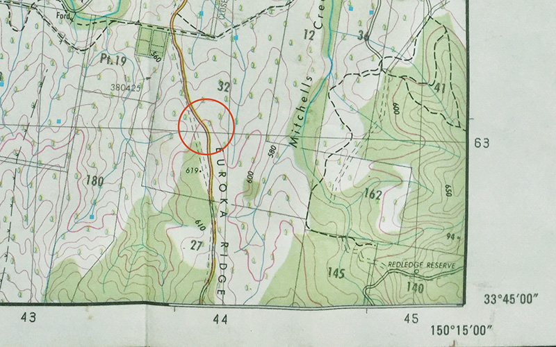 AMG
AMG
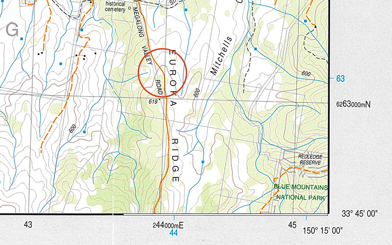 MGA / GDA94
Any given reference system is based on a datum, a 3D representation of the earth, and datums differ in how they represent land and where the location of the central frame is. Two points can be out by as little as a few hundred metres, or as much as several kilometres if there is confusion over the reference system in use.
Maps usually have an information section that identifies the map datum and projection, along with the publisher and copyright information. When communicating a grid coordinate, state the coordinate system first, then the grid coordinates.
In NSW, the 1:25000 topographic maps use either the AMG or the MGA coordinate systems.
– AMG: The AMG is the Australian Map Grid 1966/1984 system and was used on the old series maps, mostly distributed circa the 1980s. The AMG reference system uses the Universal Transverse Mercator projection of the Australian Geodetic Datum 1966.
– MGA: The MGA is the Map Grid of Australia 1994, and is used in all the new series maps. As a general rule, all the new series maps have an aerial photo image on the reverse. The MGA reference system uses the Universal Transverse Mercator projection of the Geocentric Datum of Australia 1994 (GDA94).
The AMG system was used until roughly the mid-90s when it was replaced with the MGA system, which is more compatible worldwide as the GDA 94 datum is almost identical to the WGS84 datum used in GPS (Global Positioning Systems). The result of the change from the AMG system to the MGA system is a shift of approximately 200 metres in a northeasterly direction.
While being off by 200 metres doesn’t sound like much, in the bush this can be disastrous for an emergency operation, or cost a bushwalking party serious time delay. That’s why it’s important to communicate which reference system is being used and to know how to convert between them. In an emergency, it may be possible to get enough mobile phone coverage to contact the emergency services and communicate the location of rescue.