GPS units are an excellent tool for identifying and plotting locations along a bushwalk. GPS units can also be loaded with a basic topographic map and route plan at home, and users can follow the route in the field. Alternatively, users can identify specific locations along the walk and translate them back onto a topographic map to double check their location and accuracy of navigation.
GPS units act as an additional navigation tool to traditional map and compass. They typically give accuracy up to 20 m but rely on good satellite coverage. GPS units fail in regions where the sky is partially or wholly obstructed (caves, cliff lines, canyons).
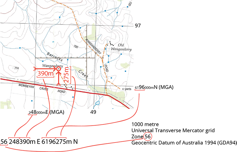
Before use set the GPS unit to the correct Geographic Coordinate System, based on the type of maps being used. The most common system that bushwalkers use is the UTM/UPS system (not latitude/longitude). Then select the appropriate datum: for new series maps use WGS 84 (or GDA 94 as they are essentially the same); for old series maps use AGD66. If unsure, read the fine print in the publication details of the map. All datum and reference modifications on a GPS can be made in the ‘settings’ section.
Reading a grid reference on a GPS
A GPS grid reference looks something like this:
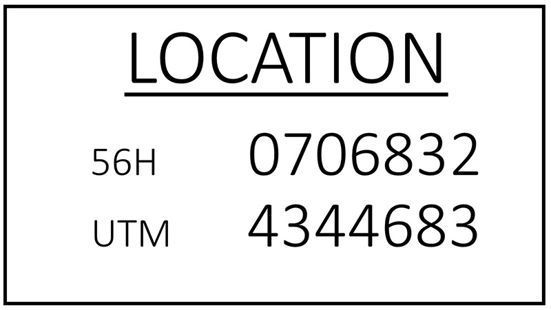
It includes information on the Geographic Coordinate System used (UTM), the location zone (56H), the Eastings (0706832) and the Northings (4344683). Eastings are always given first.
The ‘706’ part of the Easting information refers to a major Easting line, and the ‘832’ gives the location down to the nearest metre. The ‘4344’ part of the Northing information refers to a major Northing line, and the 683 gives the location down to the nearest metre in the grid.
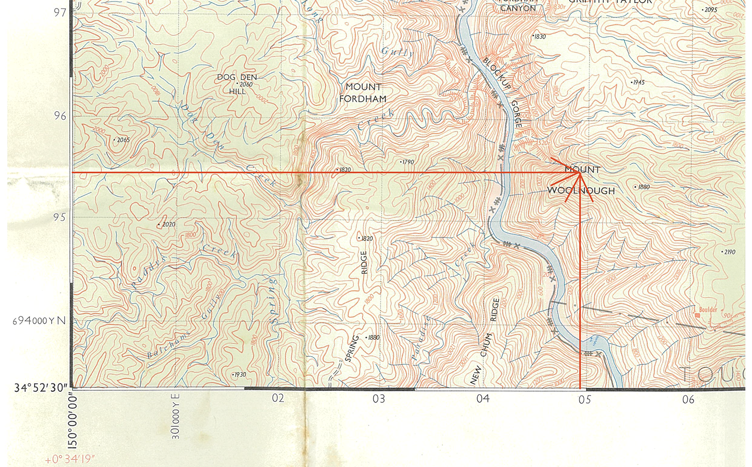
Translating a GPS reading onto a map
Example: Finding the GPS coordinate Zone 56H, 0304920mE, 0695440mN.
The map below is in Zone 56H. Major Easting lines are 04, 05, 06, etc. and all have a ‘3’ at the start. Major Northing lines have 95, 96, 97, etc. Eastings have a ‘3’ prefix shown on the map, which is ‘03’ in the GPS coordinates. Similarly, the Northing lines have a ‘6’ prefix shown on the map, which is ‘06’ in GPS coordinates.
Hence, the 8-digit grid reference is 04929544. Follow the Eastings along to the 04 line, and then 92/100th further east. Follow the Northings to the 95 line and 44/100th further north.
The location is Mount Woolnough.