
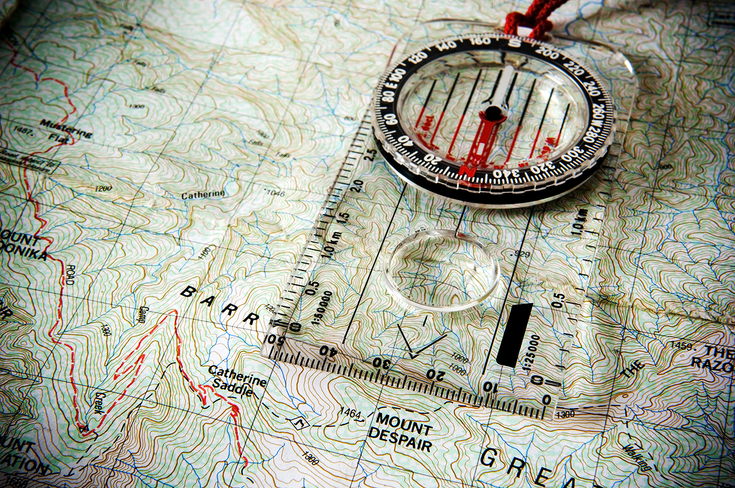
A compass is a device that shows the user magnetic north. Contrary to popular belief, it doesn’t instantly tell you where you are! Rather, it’s a tool that bushwalkers use in combination with a map and the landscape to help figure out where they are.
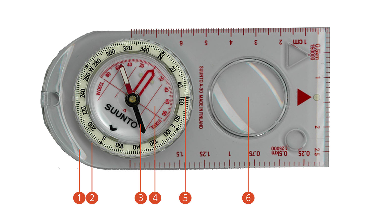 Compass Anatomy
There are many different types of compasses, but for bushwalking, it’s important to get a unit that can reliably measure bearings and help the user determine their travel route.
While all compasses are made up of the same general anatomy – a baseplate with arrows in the direction of travel, a rotating bezel with degrees markings, and a magnetic needle held within a housing unit with orienting lines on it – compasses also have a number of additional features like mirrors that may be appealing to some users.
Beware of cheap substitutes like compasses on keyrings and toy units. Spend the money for something that is lightweight, compact and reliable.
Basic Features:
1 Baseplate: The transparent panel on the base of the compass. Usually with ‘direction of travel arrow’ for orientation and ruler markings for calculating distances. The direction of travel arrow points in the direction you need to travel after setting a bearing.
2 Azimuth ring/rotating bezel: This rotating bezel has degrees markings from 0 to 359° around the outer edge, and encircles the needle capsule. The finer the scale, the more precise the navigation can be.
3 Magnetised needle: A black and red needle usually suspended in a damping fluid to help steady the movement. The needle spins freely on a mid-axis and the red end settles pointing towards the north magnetic pole.
4 Needle housing with orienting lines and arrow: Needle housing contains magnetised needle and damping fluid. It has orienting lines that can be aligned with the vertical grid lines on a map.
The orienting arrow is aligned with 0° or North on the housing.
5 Index line: The index line is an extension of the direction of travel line. It is fixed and marks any bearing that has been set by rotating the compass housing.
Additional:
6 Magnifying glass: for more detailed reading of map features
7 Declination adjustment: Some compasses have a declination adjustment feature where it’s possible to adjust the “declination” (ie. the difference between true north and magnetic) to match the area you are walking in. Thus, for every measurement, you don’t need to account for declination, rather instead, it’s taken into account for you. This works well if you are regularly using your compass in one area, and only need to reset it when you travel to a new area.
8 Sighting mirror: Can be helpful to aim more precisely for a distant landmark, especially in open terrain. Mirror can also double as an emergency aid for signally.
9 Global needle: Standard compasses only work in one hemisphere, so they are either northern or southern hemisphere specific. More expensive models can work in both hemispheres and therefore function well worldwide.
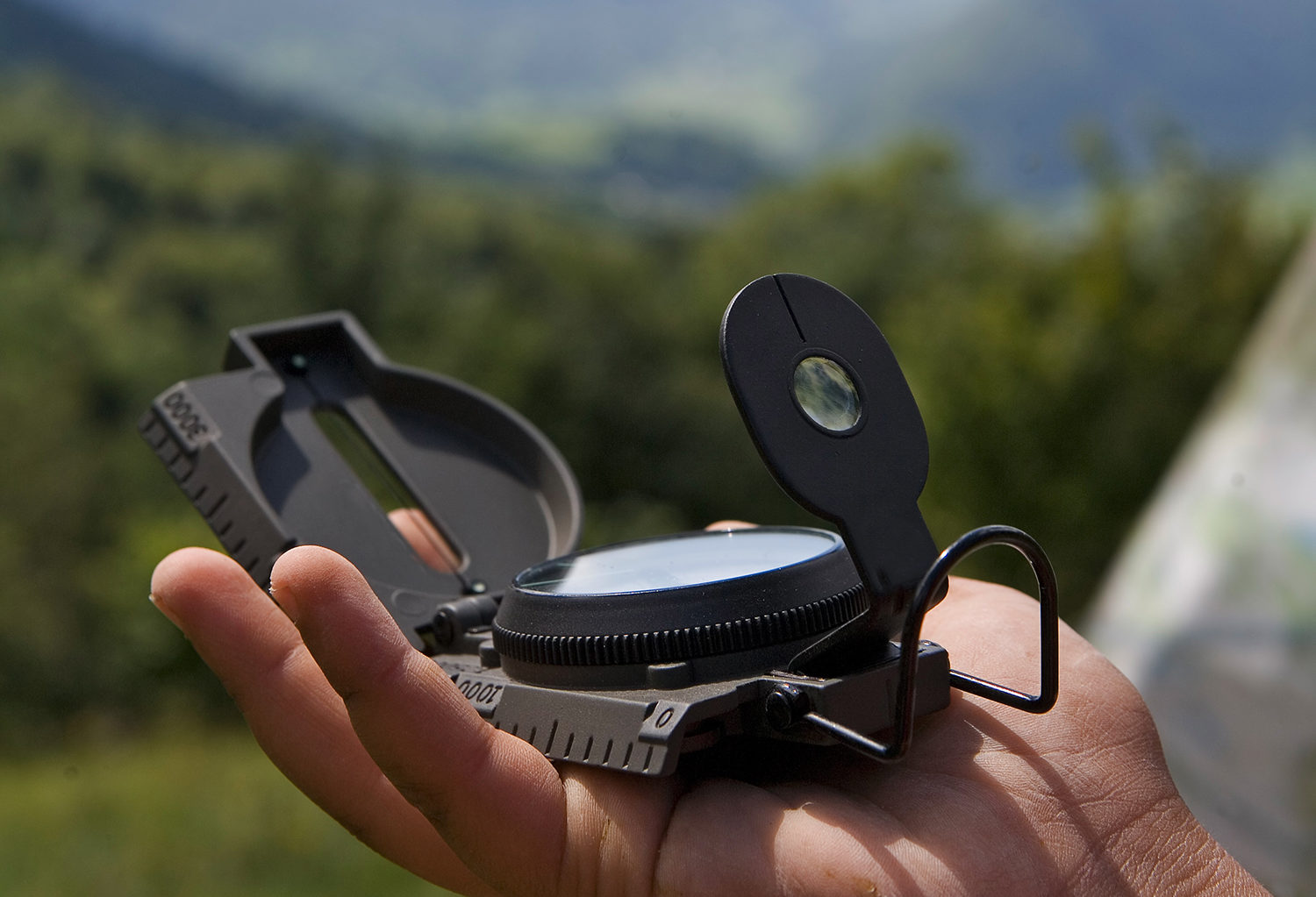 Compass Use
Compasses have a small magnetic needle suspended in fluid that rotates freely around a fixed axis until it settles pointing towards magnetic north.
Bushwalkers can use a compass in two directions: (i) to read a bearing off a map and applying that to real life, or (ii) to read a real life bearing and apply that back to the map. In practical terms, this means that a bushwalker can use a compass to determine the direction or bearing from A to B from a map, then follow that bearing in real life. Alternatively, they can take a reading in real life and put it back on the map to help figure out where they are.
A compass enables the user to orientate the map in the direction of sight, helping the user to match map features with the physical surroundings. A compass bearing of a road direction, a creek direction, the orientation of a set of powerlines can also help bushwalkers to determine where they are on the map.
However, compasses do have their flaws. Since they rely on the earth’s magnetic field to align, any strong metal object or magnetic substance nearby can send the needle haywire. For example, metal implants in packs, clothing and phones. A common mistake is to set the map up on the bonnet of the car, but the compass needle will not point north.
In some parts of the world, the ground has high metallic content. Compasses are completely useless in these areas as the compass needle never points north.
Switching between hemispheres is another common problem with compasses. A northern hemisphere compass doesn’t work in the southern hemisphere and vice versa (unless you have a special compass that can do both).
And once the fluid around the needle gets a bubble in it or leaks, the game is over. The compass is unlikely to be accurate or work ever again. Unfortunately, it’s a common problem when traveling.
Users also have to be aware of magnetic variations and how far off north they are at any given time. The adjustment introduces another degree of human error into the situation.
All that said, people do love compasses. They’re something most people are comfortable with and used to. Just be aware of some of the issues around using them. Don’t forget to fasten your compass securely to your map case or neck so you don’t lose it!
 Map measurements
 Staying found
 Magnetic Declination
Magnetic declination is the difference between true north and magnetic north. It changes depending on where you are standing on the earth. Bushwalkers need to take this into account when using a map and compass, as even a difference of 10° in a navigation bearing can lead to substantial navigation errors.
To recap:
True North is north, according to the earth’s axis. True north points to the North Pole.
Grid North refers to the direction northwards along the map projection grid lines. This comes from a 3-D object (the earth) being depicted on a 2D object (a map).
Magnetic North is the direction that a compass needle points to. Magnetic north is the direction of the Earth’s magnetic field lines.
The difference between True North and Magnetic North is referred to as the Magnetic Declination.
Bushwalkers can compensate for this difference by using charts of declination or local calibration that show the correct conversion (and rate of annual change). The easiest way to determine this is to use the tool in the map key that looks something like the image.
The difference between grid north and true north is typically within 2°. For bushwalkers, grid north is the more relevant measurement as it allows you to use the UTM grid lines as your north reference (assuming that 2° difference between grid north and true north is an acceptable margin of error – most of this time in a bushwalking context this is fine). If the map does not have the numbers, but only intersecting lines, place the compass on the lines and measure the difference (for Sydney region, it’s roughly 12°).
 What is a map?