
The walks here have been arranged into reasonably small chunks. It is possible to break some of the longer walks into even smaller sections — read through the notes to see where the road access points are. In most cases, if the walk does not split at these points it is because access is via a particularly rough dirt road or a long sidetrack.
The Great North Walk can be divided into 30 walks, each can be completed in a day walk, some can be combined and still completed in a day.
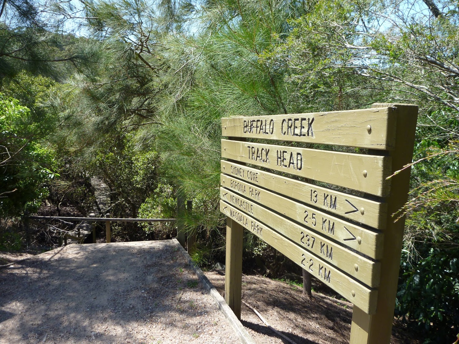
This walk is the southern most stretch of the Great North Walk and spends much of the time exploring the scenic and historic urban areas around Woolwich and Hunters Hill. Starting at the birth place of modern Sydney you soon enjoy a ferry ride across the world renowned harbour, passing the Opera House and heading under the Harbour Bridge. Once on dry land again you will explore the streets and some lovely pockets of remnant bushland of this peninsula. There are a few chances to stop at a cafe along the way before coming to open area at Boronia Park.
 Day walks
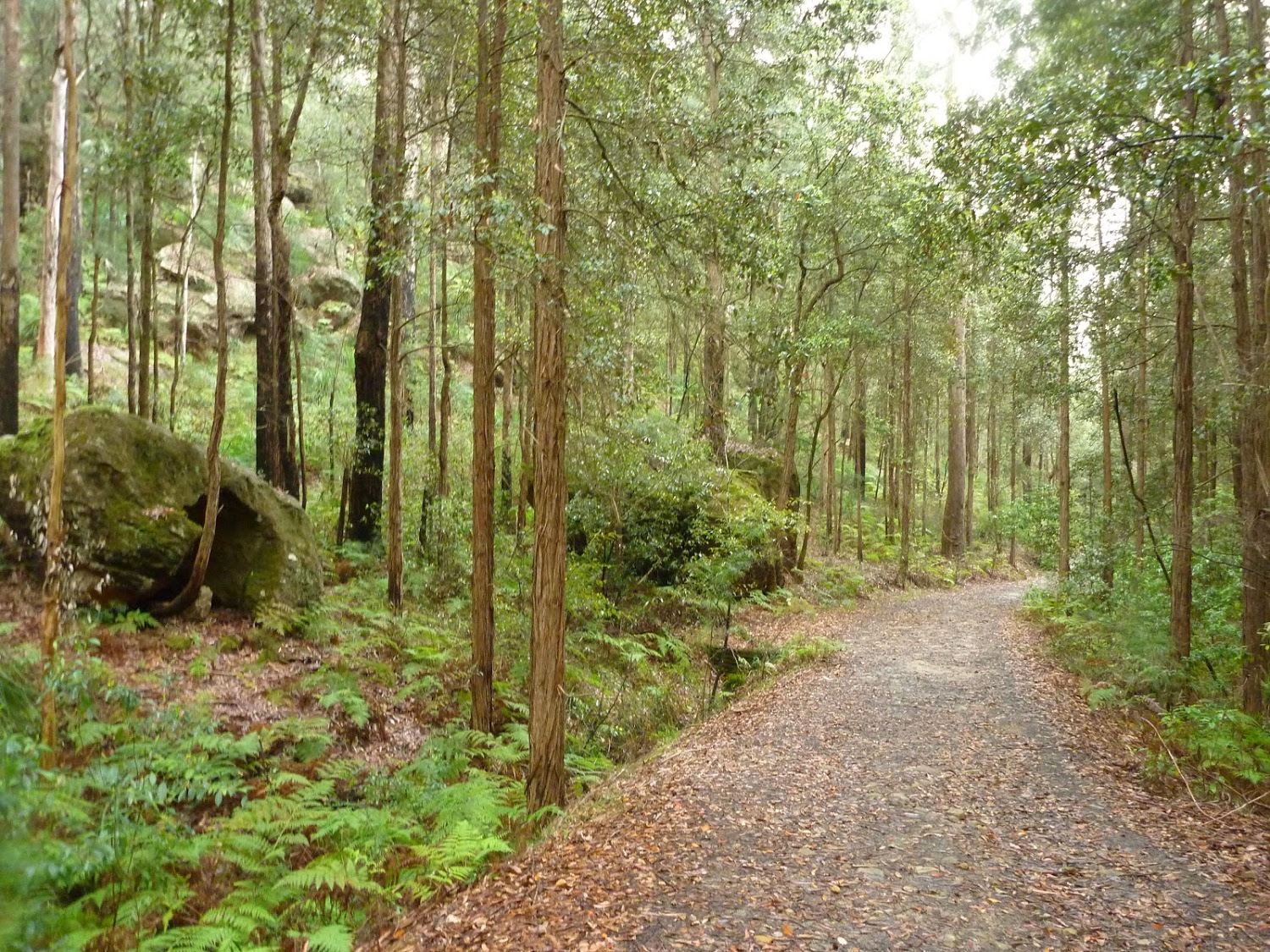
This walk gives you the chance to explore the bush and wetlands alongside the Lane Cove River, from Boronia Park to the new underground train station at North Ryde. You will visit several mangrove wetlands, some dry eucalypt forests and have the opportunity to rest and fill up your water bottle at a few well-maintained parks. This walk follows the GNW most of the way, until soon after passing under Epping Road where you take a detour up through the Riverside Corporate Park to Delhi Rd and the train station.
Starting at Thornleigh Station this walk takes you through suburban streets for a short while before diving into the bush at the southern end of Berowra Valley Regional Park. Soon after visiting the site of the historic Zig Zag railway you start wandering through the Berowra Creek valley, passing a few cascading creeks. The track undulates along the side of the valley visiting a range of environments from moist fern forest to the drier grass tree and eucalypt forests of the ridge. There is a short side trip to visit the Westleigh engravings and a chance to pop down to fishponds, before climbing up the depression era stone steps to Hornsby station.
Starting at Hornsby Station, you soon head into the bush and down the steep depression era stone steps through the volcanic Old Mans Valley, to a picnic area at the end of Rosemead Rd. Here you follow the Blue Gum walk through one of Sydney’s rare Blue Gum Forest stands to then cross Berowra Creek a few times at Fishponds waterhole. After exploring the edge of the valley you will cross the Steele Military Bridge before climbing to Tunks Ridge rest area. Not far from here the walk starts to lead steeply down enjoying more sandstone caves to cross under Galston Road and to finish off at Crosslands. Note this walk was re-routed in early 2016 to go via the streets of Hornsby Heights. This re-route is due to the multi-agency decision to close the Fishponds to Steele Bridge section of the Benowie Track. This decision has upset many people and the protest continues.
This walk heads from Crosslands over the ridge to follow Lyrbird Gully up to the train station at Mt Kuring-gai. This enjoyable section of The Great North Walk spends most of the time enjoying the wide tidal creeks in the deep valleys. There are many grass trees and sandstone caves to enjoy as well as several lovely places to camp. Crosslands provides road access, a chance to fill up the water bottle and an optional side trip to motel style accommodation at Crosslands Conventions centre. Spend much of the time on ridges enjoying scattered views across the Berowra Creek Valley, there are especially good views from Naa Badu Lookout. The walk crosses a few moist and cool gullies and scrambles for a few rocky outcrops. There are some steep climbs, and some pleasant strolls alongside the Berowra Creek. A short side trip at the end of the walk uses the ferry to cross the creek, to a cafe where you can grab a well-deserved ice cream or bite to eat.
This is a hilly walk out of the beautiful Berowra Waters valley to Cowan Station. There are many wide views across Berowra Creek providing some great excuses for well-deserved rest stops. Take your time to enjoy the views, and rock formations, and creek crossings along the way as the track leads a nearly direct route to Cowan Station, through a wonderfully remote section of bushland.
This Cowan to Brooklyn Station walk is a popular section of the Great North Walk, with scenery ranging from foreshore to ridge top lookouts. You will follow the Great North Walk from Cowan Station down to the picturesque Jerusalem Bay, then climb up over a series of ridges before descending into Brooklyn. This walk is a great one-way trip from station to station with numerous water views, including a circumnavigation of Brooklyn Dam whilst enjoying a wonderful diversity of flora along the way.
This walk explores some grand views, pleasant cascades, varied bushland and remote areas of Brisbane Waters National Park. From Patonga you will walk up the ridge and take a short side trip to enjoy the wonderful views from Warrah Lookout, before following a series of dirt roads and management trails to Patonga Creek in the heart of the national park. The walk then leads along a mix of trails and tracks mostly passing Mt Wondabyne, a worthwhile side trip, before crossing a few gullies with cool creeks and cascades. Past Myron Brook you will walk back down the water’s edge at the remote and unique Wondabyne Train Station.
Starting with a steep climb from Wondabyne Train station you will explore a series of large rock platforms with wide views over the Brisbane Water National Park and visit Scopas Peak. After Scopas walk you cross a few pleasant rocky gullies before crossing Piles Creek on the Phil Houghton suspension footbridge. Here the walk heads towards Mooney Mooney Creek before walking up to the Mooney Mooney Creek Trackhead on the Old Pacific Hwy. A side trip to Camp Kariong is also described if you want to take advantage of the well established camping facilities.
This enjoyable walk starts from where the old Pacific Hwy where you walk along dirt roads and trails for while alongside the wide Mooney Mooney Creek, and under the huge F3 Mooney Mooney bridge. The wide track continues upstream, passing a few campsites before crossing the wide creek at a pleasant large rock platform. Not too long after crossing the creek you will pass the lower Mooney Mooney Dam where the old trail leads you uphill past another campsite, a quarry to the Somersby Reservoir. The track then leads past some rural properties and across the delightful Robinson Creek among the Gymea Lilies before finishing with a section of road walking to the Somersby Store.
Starting with a walk through the streets of urban Somerbsy, you soon leave the farms and head into Palm Grove Nature Reserve. First you will follow the signposted track down the open dry ridge to the dense rainforest. In this valley you can explore the moist rainforest with towering Eucalypts, Strangler Fig trees, Cabbage Palms and a tangle of vines. From here walk up the rocky track to another dry ridge, where you can follow a side trip to a flat clearing and designated campsite. From near the campsite the track winds down through another moist forest and past more Cabbage Palms before coming to the signposted Ourimbah Valley Trackhead on Ourimbah Creek Road.
This pleasant walk explores the rural valleys and a beautiful section of Jilliby State Conservation Area. Starting at Ourimbah Valley Trackhead you walk into Hidden valley along the dirt road, to then follow a trail beside Ourimbah Creek to Stringy Bark Point. This is a pleasant mossy area with many ferns and near a wide sandy section of Ourimbah Creek. A bit further on you cross Ourimbah Creek then walk up the ridge to the dirt Tooheys Road. After turning off the old Tooheys Rd the Great North Walk leads along a narrow track and across the mossy and delightful Dead Horse Creek. The track then meanders through a heath and scribbly gum forest to Cherry Lane. After about a 1.5km road slog this walk leads you to a GNW trackhead on Great Rd.
This section of the Great North Walk explores a section of the historic Bumble Hill Dray track. You will walk along the edge of ridge mostly through open dry eucalypt forests and occasionally through moist ferny gullies as well as alongside the base of a tall rock wall. Bumble Hill Dray track was cut during the mid 1800’s to allow teams of bullocks to haul felled cedar to Mangrove Creek, where a barge would take it to Sydney. The oxen are now long gone, but this is a great way to lead into the small Yarramalong township.
Starting at the quaint Yarramalong township, this walk follows a couple of rural roads to the Cedar Brush Trackhead. This is the longest road stretch on the Great North Walk. Some people see this is a road slog and either grab a lift or power walk it, others see it as an opportunity to stroll through the countryside. However you choose to undertake this section of the walk I encourage you to enjoy the valley views and soak up the vibe on the semi-secluded rural valley community.
This section of the Great North Walk makes a good walk to a comfortable campsite, with the section along the Lyrebird Trail by the Wollombi Brook being particularly recommended. From the Cedar Brush track head, the walk winds up into the Olney State Forest through bushland (crossing over two moist gullies). Once most of your height is gained, this walk follows unsealed road before dropping down into the Wollombi Brook gully. From here, the walk follows bush tracks along Lyrebird Trail in the Olney State Forest and winds north into the Watagans, via the Warrawolong Flora Reserve. This walk also offers a side trip from Turners Road up to the top of Mt Warrawolong, which is the highest point along the Great North Walk. The walk finishes at the Watagan Creek Road and gives a nice opportunity for that quiet drive in the country.
This walk starts on Watagan Creek Road and soon crosses the lovely Watagan Creek. From this point, the walk leaves the Watagan valley and climbs steeply up the bush track through forest. The walk then travels on dirt road, passing a campsite and rest area, before arriving soon afterwards at the unfenced Flat Rock Lookout. Flat Rock Lookout is a natural rock platform that offers magnificent views across the Congewai Valley to the east and north. An enjoyable walk, offering pleasant walking through forest and an outstanding viewpoint.
Starting from the grand views of Flat Rock Lookout high on the range, you will walk down into the Congewai Valley below. On the first section of this walk, you will explore a little used dirt road to the Congewai Communication Tower. From here you follow a series of tracks that wind down, steeply in places, through the tall open forest with a scattering of grass trees to the bottom of the range. Now the walk guides you through open farmland before following Congewai Road along main valley to the trackhead near Brown Muir Farm.
This full-day walk starts from the Congewai valley trackhead (east) and follows the Great North Walk up into the Watagan National Park. Winding east along Georges road for the most part, this walk also passes many great lookouts and gives the option of a side trip down to the 125r lookout, which provides a great view to the south and nice spot for lunch. The walk finishes at the Watagan Headquarters campsite, which has a fire place and a picnic table.
This scenic walk includes dramatic lookouts and time spent in moist cool forest. The walk initially travels on dirt road past Hunter and MacLean’s Lookout, before descending into the Wallis Creek catchment. Here the walk traverses underneath many cliffs before crossing Wallis Creek and arriving at Heaton Lookout. A recommended walk with car access either end.
This section of the Great North Walk start from grand views at Heaton Lookout in Heaton state forest and leads to the picnic area and motel at Heaton Gap. The first section of this walk follows the dirt road to a communication tower before passing another lookout and expansive valley views. Here you start the steep decent along a rocky track and passing a lovely grove of grass trees. From here you follow a grassy trail and powerlines before the narrow track leads down and across the road at Heaton Gap.
This section of the Great North Walk starts from Heaton Gap near the Watagan Forest Motel, and winds east, towards Newcastle. The walk passes through the Awaba State Forest and past the Sugarloaf range, down into Wakefield and on to Teralba, a pleasant town on the edge of Lake Macquarie. Accommodation is available at both ends of this day walk.
This section of the Great North Walk starts from the Teralba train station and winds down and around the edge of Lake Macquarie. The walk passes through the Cockle reserve, and continues to Warners bay and up along the roads, before cutting through the bush to Charlestown, where it winds around the golf course and finishes at the Charlestown Park track head.
Starting from a small park in Charlestown you will follow the Great North Walk through a few reserves and along a Burwood Beach, past the heads to Merewether Beach. Exploring bush around Glenrock lagoon on the Yuelarbah Track, including the Leichhardt’s Lookout are highlights. From this lookout the track leads down past the edge of the lagoon then along the sandy beach, past Merewether ocean pools. This walk describes a side trip to the scout campsite beside the lagoon for those who have organised to camp there.
Starting from Merewether, you will mostly follow the coastline to Queens Wharf. After exploring some of Newcastle’s (and arguably Australia’s) best beaches, the grand views from Strzelecki Lookout, you then wander through King Edward Park where you can take the optional side trip to the intriguing Bogey Hole. The walk then takes you up to more panoramic views from The Obelisk, before you stroll through Newcastle CBD and mall to Queens Wharf. There are a few long hills, just take you time and enjoy the salt air.
If you have a weekend to spare, you can combine them and do them as weekend walks.
 Weekend walks