
This is a very short walk to a spectacular lookout. If you are in the area heading to Green Cape, then you really must stop here and soak up the view. Disaster Bay is named in memory of all the ships that have run aground in the region. On a sunny day, the views of the ocean, long beach and Nadgee Nature Reserve are remarkable – such a contrast to the memory of the lost ships and lives.
 Naturally Accessible Bushwalks
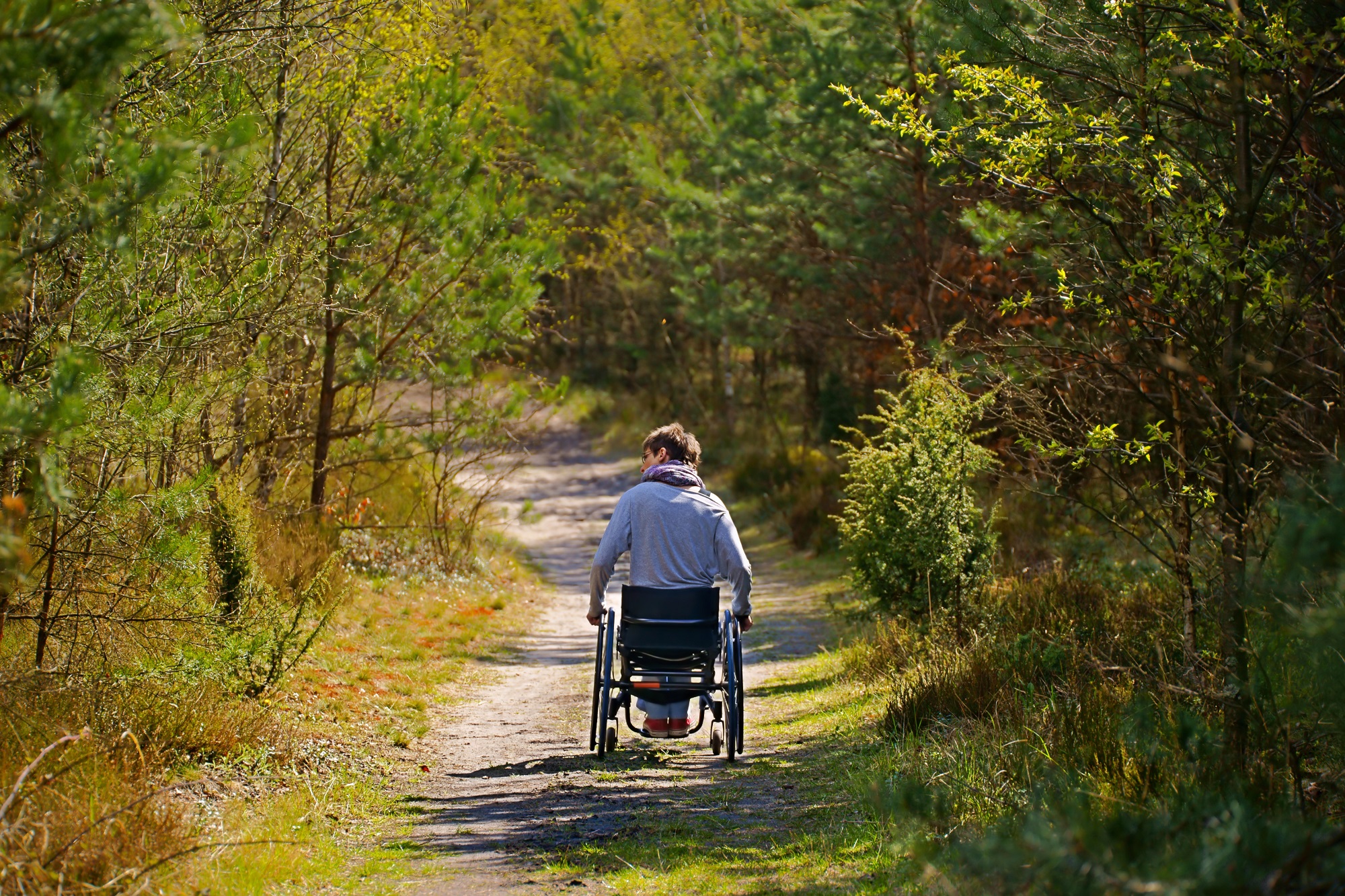
This is a short walk to a spectacular view. The walks starts with a pleasant drive along the dirt roads through the lower Blue Mountains. From the car park, the walk follows a short footpath to the fenced raised timber viewing platform. The views from the lookout are stunning and include Glenbrook Gorge, the Nepean River and Western Sydney over the Cumberland Plain. The lookout is accessible by people in wheelchairs.
This short and easy walk to to the Quibray Bay viewing/lookout platform provides some lovely views and opportunities for bird watching. The platforms give you views across the heart of the very special Towra Point Nature Reserve. The nature reserve is very close to Sydney and most of it is closed to the public to protect the very fragile ecosystems and the resting area for migratory birds. This walk gives views that most Sydneysiders never see.
The lookout at North Tura is not far from the car park and is well placed above the heath. From the end of this short walk you can see up and down the remote beach, both to the north and south, although views are limited by some taller vegetation. Bournda Island can also be clearly seen to the north. There is a toilet near the car park and the side trip leads down to some picnic tables with natural shade.
This short walk leads from the Tea Tree car park and Picnic Area to the Bird Island Lookout. The view from the fenced platform looks up and down Birdie Beach, and out to sea to Bird Island. The walk starts from the car park and heads across the compacted dirt and gravel track, before leading up a timber ramp to the actual lookout. A short walk to a grand view.
This short and easy walk leads from Tania Park to wonderful views of Arabanoo Lookout. The views over North Head and the water are wonderful. There is a concrete path leading the whole way and two seats at the top waiting for you to soak up the views. Tania Park can get busy on weekends with sport and walkers. A lovely walk if you are in the area. There are toilets, picnic area and playground at the far end of the Oval.
From Resolute Picnic Area, this walk heads out to West Head Lookout, with magnificent views across the Hawkesbury River and Lion Island. The track is a direct route which passes through classic Ku-ring-gai Chase National Park bushland. This walk offers a great way to avoid competing for parking at West Head Lookout, while enjoying more of the park.
A very pleasant and easy stroll along a path to a stunning view. Starting from Barnetts Road car park you follow the footpath through the picnic area, past the playground then meander gently downhill through the open forest among the scribbly gum trees. You soon discover a fenced lookout platform with amazing views up and down the Berowra Valley. The views of trees go on forever, on a clear day you can even see the Blue Mountains.
The Coastal Hospital Cemetery Walk is an undemanding walk, near a beautiful coastline, visiting an early Australian cemetery. The cemetery is located on raised ground, with views out to the coast and sea. Used primarily as a cemetery for the old quarantine hospital from the 1880’s, it is home to over 2000 graves (most not visible). The visible grave sites are interesting and provide a fascinating glimpse into life (and death) 100 years ago. Worth a visit if you are in the area or if you have an interest in the local history.
Tunnel View Lookout walk is a short walk along a well-maintained management trail. At the end of the wide trail is a short narrow track leading to a large mostly flat rock platform with great views. On the far side of the gorge you can just see where train tunnel goes through the hill, you can’t see the actual tunnel. You do get great views of Glenbrook Creek Gorge, the Blue Mountains and Sydney. A lovely walk.
This is a short and pretty walk that can be enjoyed by everyone. It makes a nice addition to a picnic or paddle at Bobbin Head. Starting from the southern end of the Bobbin Head picnic area, you will enjoy great views of Cockle Creek from the bridge, then meander along the boardwalk through the mangroves. There are information signs to help you learn more about the environment and plenty of opportunities to see the mangroves and crabs up close.
This very pleasant walk starts from the Katoomba Falls Park. The walk explores the cliffs and dense vegetation in the area, and enters the Blue Mountains National Park to enjoy the views from the Cliff View Lookout. The lookout provides stunning views up the Kedumba Valley. The walk is well signposted, has handrails and fencing. The walk passes under the skyway just below the eastern station. An easy walk with spectacular views.
This walk in Ben Boyd National Park is a magnificent way to explore the heritage of Boyds Tower. There are plenty of information signs that enrich the story of the stunning structure and history of the area. Boyds Tower is the centrepiece of this walk and is well worth a visit. The bottom of the tower is open to the public and makes this piece of history that much more interesting when exploring. There are two optional side trips to two lookouts with very different views, one is wheelchair accessible, the other is down a very steep set of steps.
On this short and easy walk, you will explore two lookouts with stunning views down the Grose Valley. Starting from the car park, you really should make the short side trip through the stone arch to Govetts Leap Lookout. The main walk follows the well-formed footpath through the bush up to the less visited George Phillips Lookout. There are a pleasant stone shelter and picnic tables here. Around the car park are plenty of picnic facilities and a toilet block. A great walk giving you a sense of the scale of the breathtaking Grose Valley.
This walk follows a wide concrete trail through Berowra Valley Regional Park, through lovely bushland and the site of the historic Zig Zag railway. The railway is long gone, but the quarry site is interesting to explore and crossing Zig Zag Creek on the bridge gives a lovely view down on the fern trees. Stop and read the information signs along the way, bring your dog for a walk or use this trail for fitness training. The trail on the north side of Zig Zag Creek is very steep for about 50m, otherwise, this walk is easy to follow. To save the car shuttle you can just allow extra time and retrace your steps back to the start.
This walk guides you through the historic and well-maintained outer Middle Head fortification battery. Take a step back in time, by walking along Old Fort Road past the old barracks and through the banksia forest to the open clearing and array of gun emplacements. At the fortification, you can explore the tunnels, underground rooms and circular gun emplacements and enjoy the views of the sea cliffs and harbour views.
The Mambara Track is a short walk, accessible to everyone, and a great walk for gaining some knowledge about the local bush. The walk follows a concrete footpath and has many signs with information about the surrounding bush. A great loop walk for the whole family and great introduction to the walking experiences in the area.
This walk guides you along raised boardwalk through rare and engaged banksia ecosystem. An opportunity to appreciate a sensitive environment close up and in an environmentally sensitive way. The information sign at the start of the walk provides insight into the Banksia scrub and its value. This walk is recommended if you would like to look at a type of vegetation that once covered a much larger area of Sydney. This walk is mostly downhill from Jennifer St. If the return trip is too much you can organise for someone to pick you up from Cape Banks Rd.
On this walk you will explore the historic northern or ‘inner’ Middle Head fortification battery. You can explore the trenches, tunnels and rooms of the fortifications on the less busy gun emplacements on Middle Head. The vegetation, water, cliff and harbour views are also spectacular and well worth spending a bit of time to carefully explore and soak up the sites.
This walk provides some of the best views in Sydney. This pleasant stroll and wheelchair-accessible walk starts from the car park at the end of the North Head Scenic Drive, and follows the asphalt footpath as it loops around the tip of North Head. Enjoy views of the entrance to Sydney Harbour, the coastal cliff line and a historic gun emplacement. The stunning lookouts provide great views all year round and a popular vantage point for whale watchers. The whales pass by twice annually, heading north in June and July, and again when they return to the Antarctic in August and October.
This walk is a fantastic way to see some of Ben Boyd National Park’s heritage and spectacular coastline. The walk passes the iconic sandstone Boyd Tower and continues on to the wide views from the lookout over Twofold Bay. The side trip to Red Point lookout is well worth it to see the dramatic rock folds that are found along the coast of the national park. Note that the side trip has as very steep set of steps.
This short walk follows a footpath to a large rock platform with some well-preserved Aboriginal engravings. Named after Bulgandry man, an ancestral hero and one of the more detailed engravings at the site, this is clearly a special place. The footpath gently winds through the bush before following a timber platform around the engravings. This walk is accessible for people in wheelchairs but it is important to note the path has deteriorated in some places, making it a bit bouncy.
This short stroll provides the most stunning views in the park, especially on a sunny day. You will wander past the old telegraph station, light house cottages to find the towering white & blue historic Green Cape Lighthouse. The green grass, blue sky and tower is a photographers dream. Continue along the boardwalk to pass the modern lighthouse and find the stunning rugged red rock coastal views from the fenced lookout at the tip of Green Cape. Don’t forget to look back at the lighthouse from the lookout, there really are 360-degree views.
This short walk starts near the Willow Tree Picnic Area (near Audley). The walk follows a short section of the historic Lady Carrington Drive to a large sandstone overhang called Gibraltar Rock. At the base of the overhang is a rare sandstone cobble section of road. At Gibraltar Rock, there are also good views along the Hacking River. This is a nice way to stretch your legs while picnicking in the area.
This walk gives you the opportunity to stroll alongside a creek and explore an open eucalypt forest. An easy mostly flat walk starting at a wonderful playground and picnic area, this is a walk for everyone. As you walk, you can learn more about the diverse history of the area on the information signs, sit and enjoy the bird life, or take a picnic on the side trip up the dam.
This walk leads from the information center at Echo Point down through the Blue Mountains National Park to Oreades Lookout. It is a popular walk and follows a smooth concreted path the whole way. There are no steps but sections do get steep in places. The short side trip to Spooners Lookout is well worth the extra effort. A lovely walk suitable for the whole family.
This is a smooth and mostly flat walk with a fantastic lookout in the Royal National Park. The concrete path starts at the Area Office car park, passes a pleasant and usually quiet picnic area, then winds gently down through the bush. The path leads to the fenced Bungoona Lookout, where you can enjoy views over the Hacking River and a large part of the Royal National Park. Take your time to read the signs and enjoy the plants and rock formations along the way. There are plenty of bench seats along the way to rest.
This walk guides you down a short but fairly steep trail to the beautiful Cobblers Beach. The beach is a small, pretty, and clothing-optional beach on the northern edge of Middle Head in Sydney Harbour NP. There is a grassy area above the beach if you want to picnic, and the water is generally protected from the swell, and the rocks on the shoreline are interesting to explore.
This return walk is perfect for walking with children. As you walk along the raised boardwalk you can observe animals and plants above and beneath you and learn a lot about the nature of the area.
Enjoy a pleasant meander through a varied forest from the Botany Bay Visitors Centre. This walk takes you through a lovely and diverse forest, there are plenty of small signs to help you learn about the different types of plants on the walk including a large scribbly gum and a spectacular Cabbage palm grove. It is no wonder why Joseph Banks and Daniel Solander in 1770 got so excited when walking in the area collecting, what was for them, new plant species.
This great walk starts from Crosslands Reserve. The walk follows a section of the Great North Walk along an old road, timber boardwalk and firm dirt tracks to a lovely timber lookout platform on the edge of Berowra Creek. Along the way are signs providing interesting information about the mangroves, estuaries and other surrounding flora and fauna. Make a day of it by enjoying the picnic areas and playground at the start of the walk. You can even book a campsite and enjoy the area for longer.
This pleasant stroll along a concrete footpath leads through a historically significant section of Kamay Botany Bay NP. Starting from the Visitor Centre, you take a short side trip to the Meeting Place, where you will learn more about the Aboriginal people of the area. As the walk continues down to and along the waterfront, you will pass the actual landing site for the Endeavour in 1770. You also pass a series of monuments to different men on the ship, including Captain Cook. There are also plenty of information signs to give further insight into the impacts of the Aboriginal people of the area. A lovely stroll with the chance to grab a snack at the end. This walk can be started at either end, you can allow extra time and return the same way if you prefer.
Wander among the mangroves to step back in time to explore the old Schoolmaster’s House that was part of a once vibrant community in the area. Following devastating floods in 1955, the people moved from the area, with the area still being leased as farmland. Now, these wetlands are protected as part of the national park, ensuring the survival of the endangered ecological community of saltmarsh and all the fish, birds and other animals that rely on them for survival. Bring a picnic lunch and settle under a tree, or bring binoculars and a bird guide. Take your time to enjoy all this area has to offer.
Step back in time on this short easy walk that guides you from Riverside Park picnic area to the ruins of the Milham’s family farmhouse. The farm was once a vibrant dairy, and today, you will still see cattle grazing in the fenced paddocks alongside the walk. From the banks of the north arm of the Hunter River, this walk follows the old farm road (closed to traffic) alongside the paddocks and she oak forest. There is a picnic table in the shade near the old house, a nice quiet spot to sit and reminisce on the rich history and natural beauty of the area.
A great way to explore the tree canopy and valley in one easy walk. From the carpark, you will be led along a 100 m long elevated timber boardwalk that brings you to eye level with the tree canopy. Continue into the valley following the gently undulating wide track to cross Flaggy Creek using a solid suspension bridge. From the bridge, it is just 40m to a pleasant picnic area near the creek. You will find a rough track leading down to the rock platform that forms the Flaggy Creek bed, from the picnic area. The walk is gently sloping downhill most of the way to the picnic area, so it is uphill the way back.
On this walk, you will explore Cape Banks Island, surrounded by the aquatic reserve and the beautiful coastline of Kamay Botany Bay NP. Starting from the end of Cape Banks Rd, you pass a historic gun emplacement, then explore the grassy coastline down to the water and edge of NSW Golf Course. There is a foot bridge to give access to the island and a novel T for the golf course. The island has a series of faint rough tracks that allow you to explore the bald island and its views.
Whether on foot or on wheels, this is a pleasant stroll around the asphalt bike track and footpath through Rouse Hill Regional Park. It’s a great adventure for kids or adults wanting to ramble through eucalypt forest, parkland, and an old farm. Starting from the great playground and picnic area, you will follow the footpath past plenty of picnic tables, with a toilet near the start and along the way. It’s a pleasant way to stretch the legs.
This walk is a great way to step back in time and explore the old Rouse Hill Estate. There are optional side trips that take you to some well-equipped picnic areas if you have the extra time. The walk mostly follows wide grassy trails and gives you good views of the whole estate. There are a series of information signs that help give you a deeper understanding of the history of the area. A pleasant stroll around an old farm site.
Take this leisurely one-way walk along the Hunter River. Check out the visitor information shelter for info about the first settlers, then have a picnic at the Riverside Park or go fishing off the jetty.
The Fairfax Heritage Track is an easy stroll and a wheelchair-accessible walk through a lovely open forest. The walk leads from the NPWS visitor information centre downhill to the stunning views from George Phillips and Govetts Leap lookouts. There are bench seats to rest on and wonderful sheltered picnic areas at the lookouts. Parking and toilets at the start and end.
Rainforest walk to Riverside Park takes you along mostly flat track through Hunter Wetlands National Park. See a historic silos and ruins of Milham’s Farmhouse on the way, then have a picnic at the Riverside Park or go fishing off the jetty.
This walk starts at the historical and beautiful Audley picnic area and dance hall. Have a picnic or enjoy a coffee from the cafe, before wandering along the quiet public road alongside Hacking River. After heading around the locked gate, you walk along the old Lady Carrington Drive trail for about 450m to Gibraltar Rock and lovely views over the Hacking River. Retrace your steps to enjoy another coffee and get back to the car.
Explore the bank of the north arm of the Hunter River by following an old road from one picnic area to another. Starting from the well established Riverside Park picnic area, you wander along the mostly flat walk, following the asphalt and gravel trail along the banks of the river, through a She Oak forest and beside the wetlands. A great walk for enjoying the birdlife and varied forest along the way. There are a series of picnic tables along the way and a sheltered seating area at Scotts Point. Once you are ready, retrace your steps back to the car.
This walk guides you around, then through the wetlands via Scott Point. You first walk along an old closed road on the banks of the Hunter River (north and south arms) then you meander along the lovely boardwalk through the heart of the wetlands then along the rainforest track to see a greater diversity of plants. You then return to the start by walking along a few roads giving you the sense of a stroll through rural farmlands. This lovely circuit walk gives you the sense of the variety of life in the precious ecosystem.
Starting from Claude’s Car Park, North Narrabeen, this walk takes you on a circuit around Narrabeen Lagoon, visiting Cement Works Lookout, berry Reserve and many other areas of interest along the way. You can enjoy the open views of the lagoon and have your lunch at any picnic area situated along the path. It is also possible to swim in the lagoon along with other activities such as canoeing, kayaking, snorkelling and fishing. You can also observe the duck ponds, beautiful flowers and black swans. Dogs are allowed in the area but on a leash for the protection of wild birds. The texture of the track varies between paved and boardwalk, and it is relatively flat. There are cyclers and runners along the walk, and it is a quite popular area. You might want to bring sunscreen with you as there can be certain sections that have less shade.
This walk follows the historic Lady Carrington Drive alongside the Hacking River. The old road is closed to traffic and provides a great way for walkers (and mountain bikers) to explore the richness of Royal National Park. You can explore the fantastic natural sandstone rock formations and historical artefacts, read the information signs, rest in the picnic areas and appreciate the magnificent native trees. You may well be lucky enough to spot lyrebirds. The southern end has the steepest sections with the walk becoming generally flatter as you head north.