| Turn map |
Directions & comments |
 x x |
(0 km) At the intersection of Old Great North Road & Settlers Road Start heading along Old Great North Road (a vehicle track).
 (0 km) After 25yd head through/around the gate.
 (0 km) Then find the "Old Great North Road" (on your left).
 (0 km) After another 25yd pass the "1 Welcome" (on your right).
 (0.1 km) After another 35yd pass the "Indigenous outline" (17ft on your left).
(0.1 km) After another 55yd pass the artwork (on your left).
(0.2 km) After another 55yd pass the "Australian convict sites" (on your left).
(0.2 km) After another 40yd pass the "Why Devines Hill?" (16ft on your left).
(0.3 km) After another 60yd pass the "3 Culvert and table drain" (16ft on your left).
(0.5 km) After another 235yd pass the "4 The large rock cutting" (on your left). |
 x x |
(1.1 km) After another 660yd (from the Old Great North Road) continue straight, to head along Old Great North Road.
(1.1 km) After another 32ft find the "Hangmans Rock" (on your right). |
 x x |
(1.4 km) After another 380yd (from the Old Great North Road) continue straight, to head along Old Great North Road.
(1.8 km) After another 390yd head through/around the gate. |
 x x |
(1.8 km) At the intersection of Old Great North Road & Shepherds Gully Road veer right, to head along Old Great North Road.
(1.9 km) After another 95yd find the "Devines Hill" (on your left). |
 x x |
(2.2 km) After another 360yd (at the intersection of Old Great North Road & Finchs Line) continue straight, to head along Old Great North Road. |
 x x |
(4.1 km) After another 1.2mi (from the Old Great North Road) continue straight, to head along Old Great North Road. |
 x x |
(5.1 km) After another 1070yd (from the Old Great North Road) continue straight, to head along Old Great North Road. |
 x x |
(5.4 km) After another 380yd (from the Old Great North Road) continue straight, to head along Old Great North Road. |
 x x |
(11.8 km) After another 3.9mi (at the intersection of Old Great North Road & Western Commission Track) continue straight, to head along Old Great North Road. |
 x x |
(12.9 km) After another 0.7mi (at the intersection of Old Great North Road & Eight Mile Trail) veer right, to head along Old Great North Road. |
 x x |
(13.6 km) After another 860yd (at the intersection of Old Great North Road & Wat Loop Trail) continue straight, to head along Old Great North Road.
 (15 km) After another 0.8mi find the "Wat Buddha Dhamma" (44ft on your left).
 (15.6 km) After another 660yd come to the "Ten Mile Hollow" (50yd on your right). This is a free campsite. |
 x x |
(15.6 km) At the intersection of Old Great North Road & Simpsons Track continue straight, to head along Old Great North Road.
 (15.6 km) After another 50yd pass the toilet (80yd on your right).
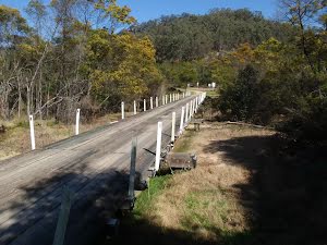
 (15.7 km) After another 55yd cross the bridge (about 7 m long)
(15.7 km) After another 24ft head through/around the gate. |
 x x |
(16.7 km) After another 0.6mi (at the intersection of Old Great North Road & Old North Road) continue straight (a walking trail).
(16.8 km) After another 65yd find the "Clares Bridge" (20ft on your right). |
 x x |
(16.8 km) At the intersection of Old Great North Road & Old North Road veer left, to head along Old Great North Road (a vehicle track). |
 x x |
(17.3 km) After another 540yd (at the intersection of Old Great North Road & Wat Loop Trail) continue straight, to head along Old Great North Road. |
 x x |
(17.6 km) After another 300yd (at the intersection of Donnys Track & Old Great North Road) continue straight, to head along Donnys Track. |
 x x |
(18.9 km) After another 0.8mi (from the Donnys Track) continue straight, to head along Donnys Track.
 (21.4 km) After another 1.6mi find the "Donny's View" (41ft on your left). |
: An optional side trip to Fairview Homestead.