| Turn map |
Directions & comments |
 x x |
(0 km) At the intersection of Old Great North Road & Settlers Road 开始 沿 Old Great North Road 前进 (一条泥路).
 (0 km) After 20米 穿过或绕过的大门.
 (0 km) 然后几乎立即 找出"Old Great North Road" (在你的左).
 (0 km) 又过了25米 通过"1 Welcome" (在你的右).
 (0.1 km) 又过了30米 通过"Indigenous outline" ( 左边5米).
(0.1 km) 又过了50米 通过艺术品 (在你的左).
(0.2 km) 又过了50米 通过"Australian convict sites" (在你的左).
(0.2 km) 又过了40米 通过"Why Devines Hill?" ( 左边5米).
(0.3 km) 又过了55米 通过"3 Culvert and table drain" ( 左边5米).
(0.5 km) 又过了215米 通过"4 The large rock cutting" (在你的左). |
 x x |
(1.1 km) 又过了600米 (from the Old Great North Road) 继续直,沿着Old Great North Road前进.
(1.1 km) 又过了10米 找出"Hangmans Rock" (在你的右). |
 x x |
(1.4 km) 又过了345米 (from the Old Great North Road) 继续直,沿着Old Great North Road前进.
(1.8 km) 又过了360米 穿过或绕过的大门. |
 x x |
(1.8 km) At the intersection of Old Great North Road & Shepherds Gully Road 变向进攻右,沿着Old Great North Road前进.
(1.9 km) 又过了90米 找出"Devines Hill" (在你的左). |
 x x |
(2.2 km) 又过了330米 (at the intersection of Old Great North Road & Finchs Line) 继续直,沿着Old Great North Road前进. |
 x x |
(4.1 km) 又过了1.9公里 (from the Old Great North Road) 继续直,沿着Old Great North Road前进. |
 x x |
(5.1 km) 又过了980米 (from the Old Great North Road) 继续直,沿着Old Great North Road前进. |
 x x |
(5.4 km) 又过了345米 (from the Old Great North Road) 继续直,沿着Old Great North Road前进. |
 x x |
(11.8 km) 又过了6.3公里 (at the intersection of Old Great North Road & Western Commission Track) 继续直,沿着Old Great North Road前进. |
 x x |
(12.9 km) 又过了1.1公里 (at the intersection of Old Great North Road & Eight Mile Trail) 变向进攻右,沿着Old Great North Road前进. |
 x x |
(13.6 km) 又过了790米 (at the intersection of Old Great North Road & Wat Loop Trail) 继续直,沿着Old Great North Road前进.
 (15 km) 又过了1.4公里 找出"Wat Buddha Dhamma" ( 左边15米).
 (15.6 km) 又过了600米 来到%s ( 右边45米). 这是一个免费的露营地 |
 x x |
(15.6 km) At the intersection of Old Great North Road & Simpsons Track 继续直,沿着Old Great North Road前进.
 (15.6 km) 又过了45米 通过厕所 ( 右边75米).
 (15.7 km) 又过了50米 穿过桥 (约7 m长)
(15.7 km) 又过了7米 穿过或绕过的大门. |
 x x |
(16.7 km) 又过了1公里 (at the intersection of Old Great North Road & Old North Road) 继续直 (一条步行径).
(16.8 km) 又过了60米 找出"Clares Bridge" ( 右边6米). |
 x x |
(16.8 km) At the intersection of Old Great North Road & Old North Road 变向进攻左,沿着Old Great North Road前进 (一条泥路). |
 x x |
(17.3 km) 又过了500米 (at the intersection of Old Great North Road & Wat Loop Trail) 继续直,沿着Old Great North Road前进. |
 x x |
(17.6 km) 又过了270米 (at the intersection of Donnys Track & Old Great North Road) 继续直,沿着Donnys Track前进. |
 x x |
(18.9 km) 又过了1.3公里 (from the Donnys Track) 继续直,沿着Donnys Track前进.
 (21.4 km) 又过了2.6公里 找出"Donny's View" ( 左边10米). |
启动可选的侧面跟踪: An optional side trip to Fairview Homestead.
| Turn map |
Directions & comments |
 x x |
(0 km) 在这里开始这个可选的旅行 继续直。开始. |
 x x |
(1 km) 又过了970米 继续直.
(0 km) 距离终点约95米 是 "Fairview". |
 x x |
(0 km) 结束.
 (0 km) Turn around and retrace your steps back the 0米 to the main route.
(0 km) 您现在回到了主要路线回,并按照23公里个航路点的指示进行操作 |
| Turn map |
Directions & comments |
 x x |
(23 km) 又过了1.6公里 (at the intersection of Dubbo Gully Road & Ten Mile Hollow Road) 继续直,沿着Dubbo Gully Road前进 (一条泥路).
(23.7 km) 又过了720米 找出"Upper Mangrove Cemetery" ( 右边9米).
(24.7 km) 又过了1公里 穿过桥 (约60 m长) 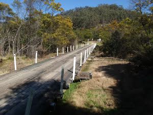
(27.3 km) 又过了2.5公里 来到 a 的大门. |
 x x |
(27.3 km) Continue another 0米 to find from the Dubbo Gully Road at the end. |
